Ulrich Formann
Ground Truth
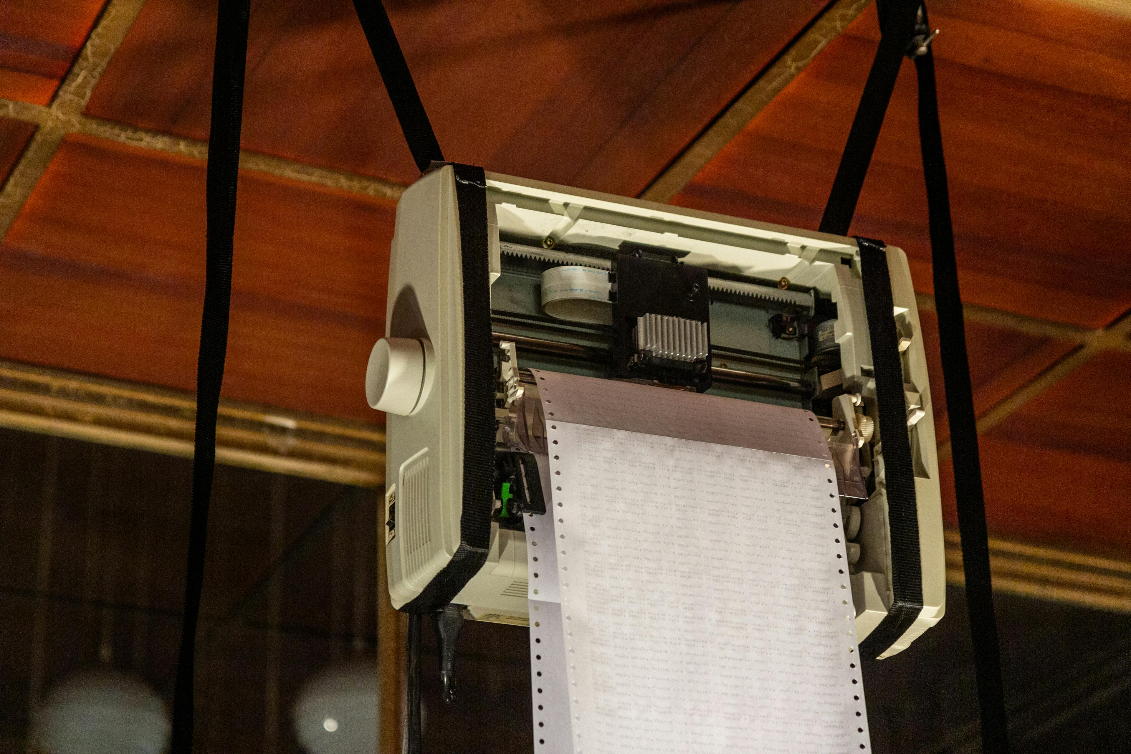
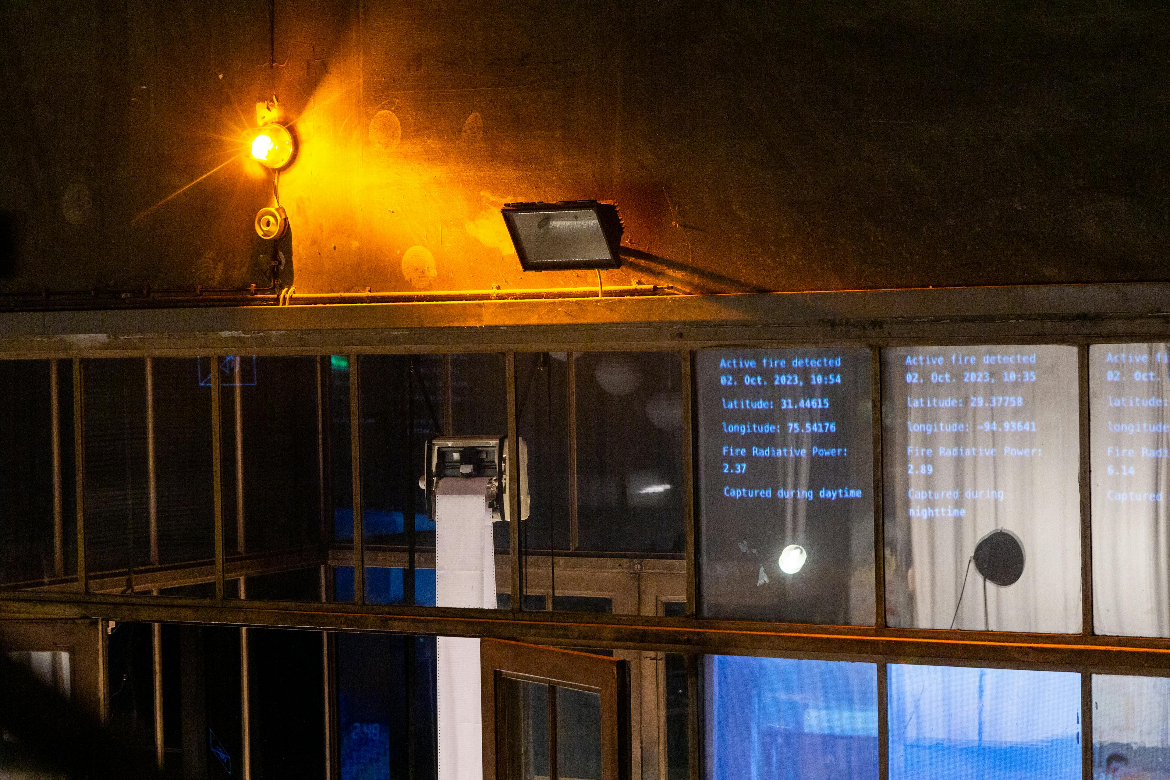
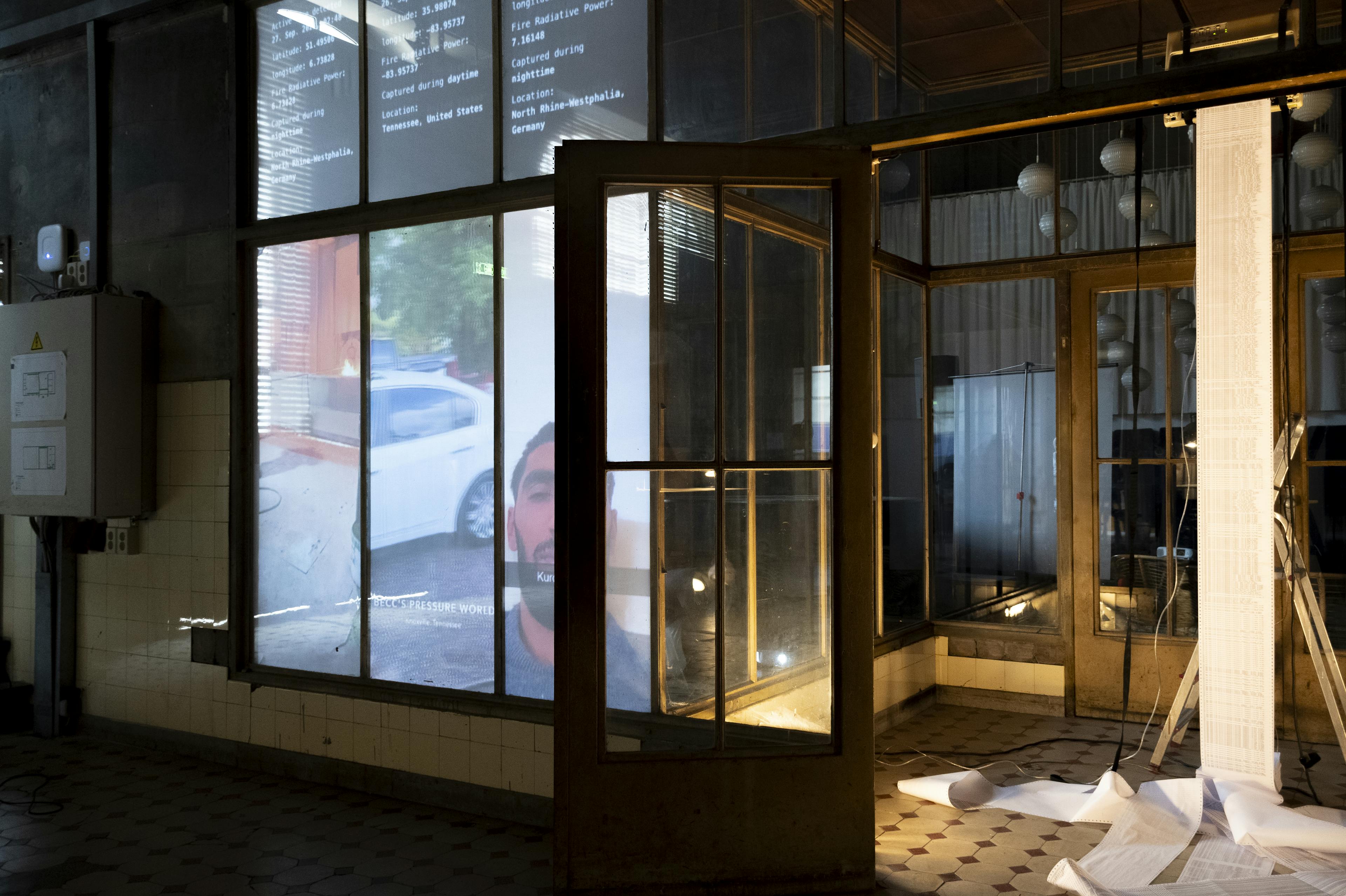
Site-Specific Real-Time Installation, 2023
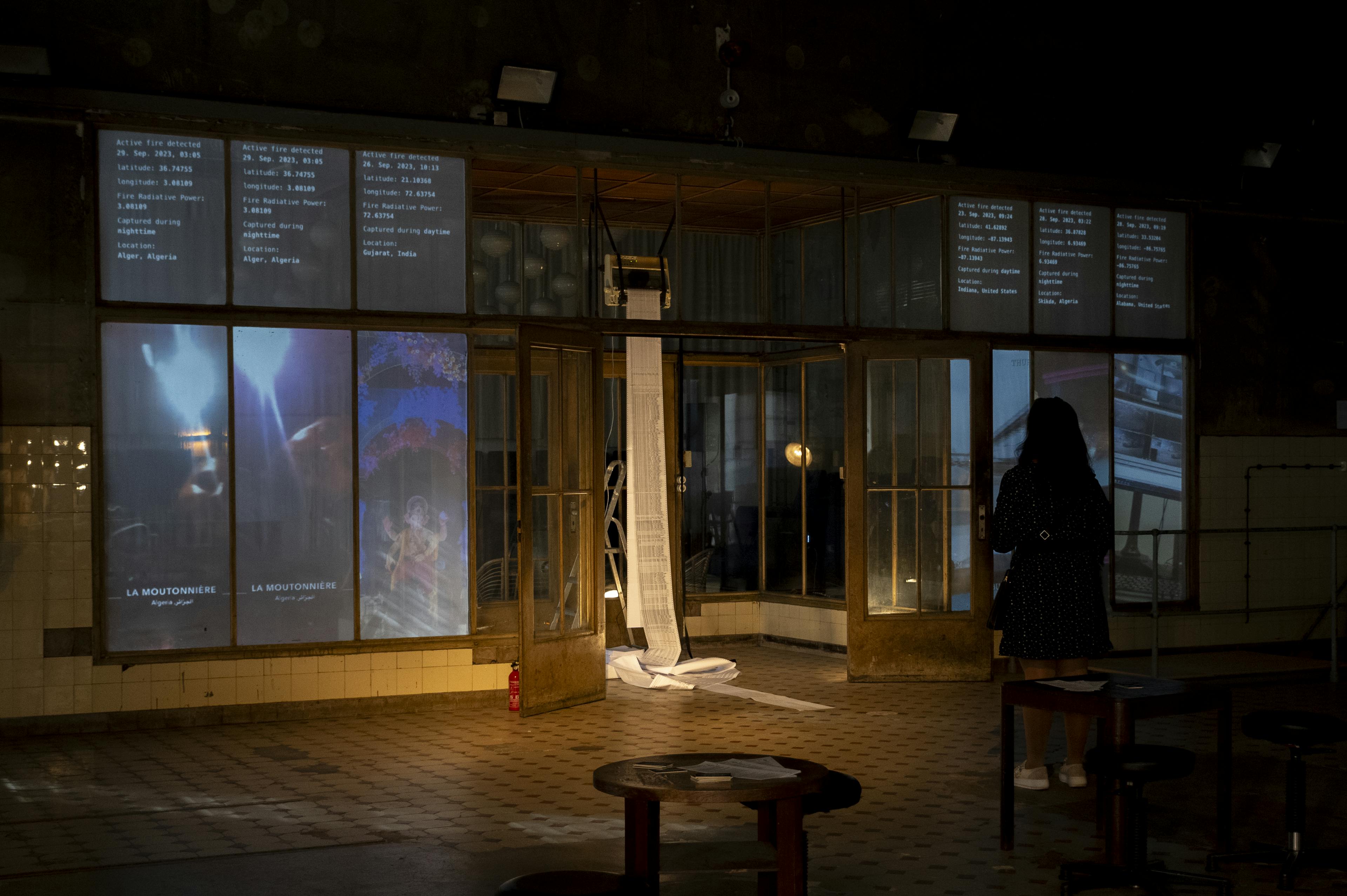
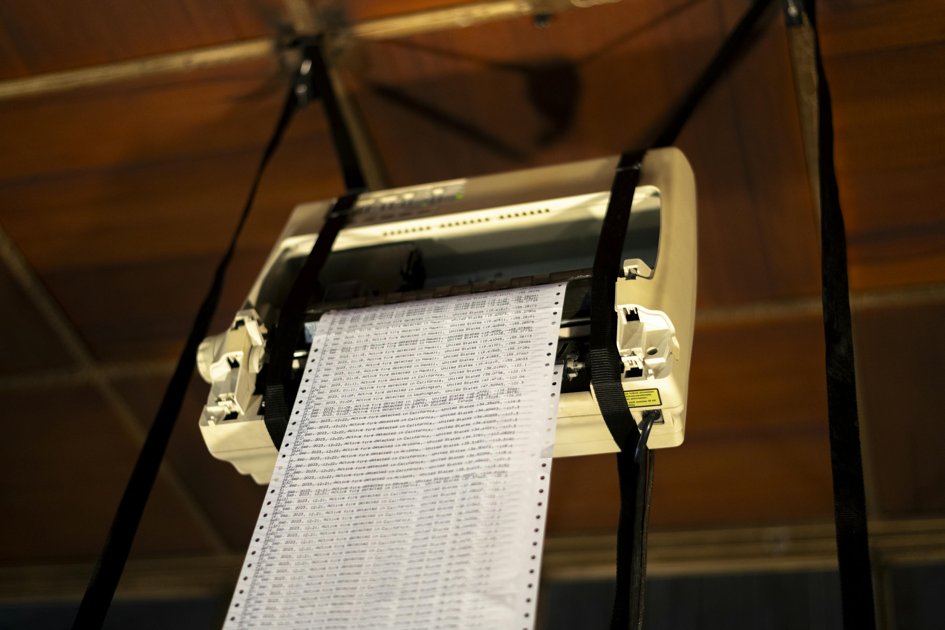
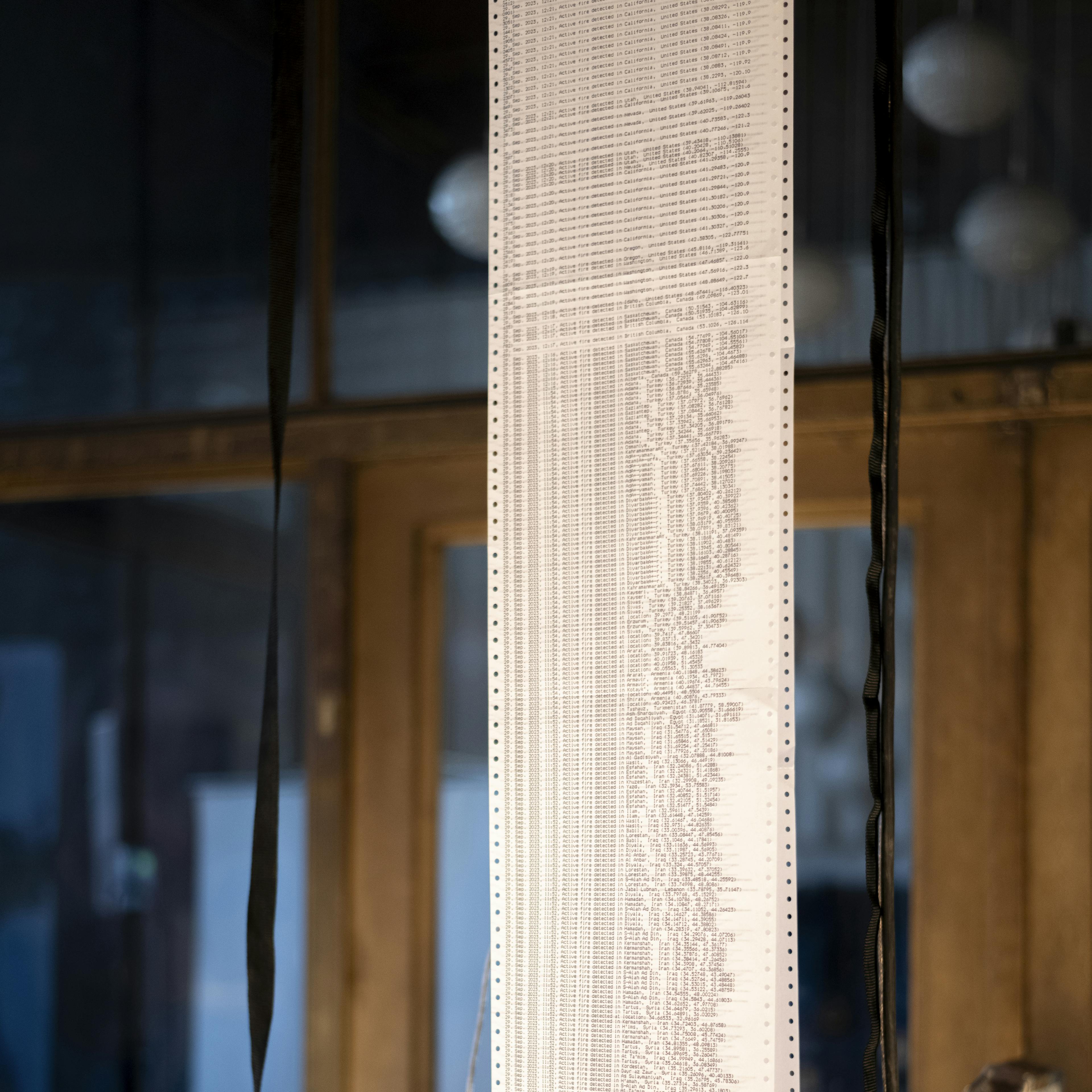
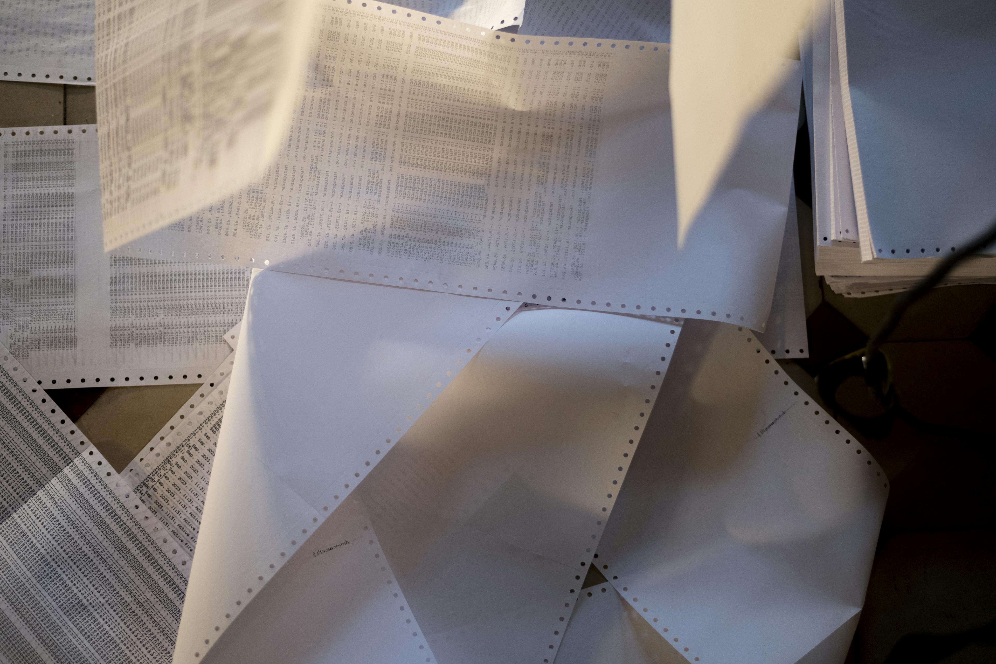
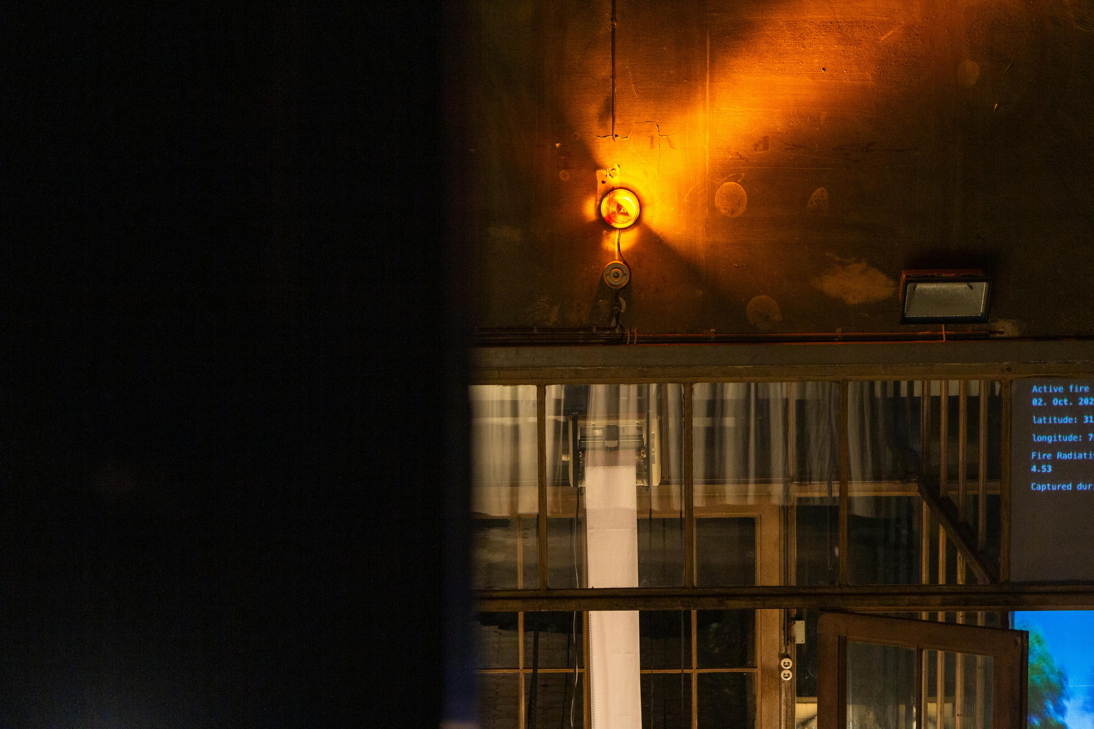
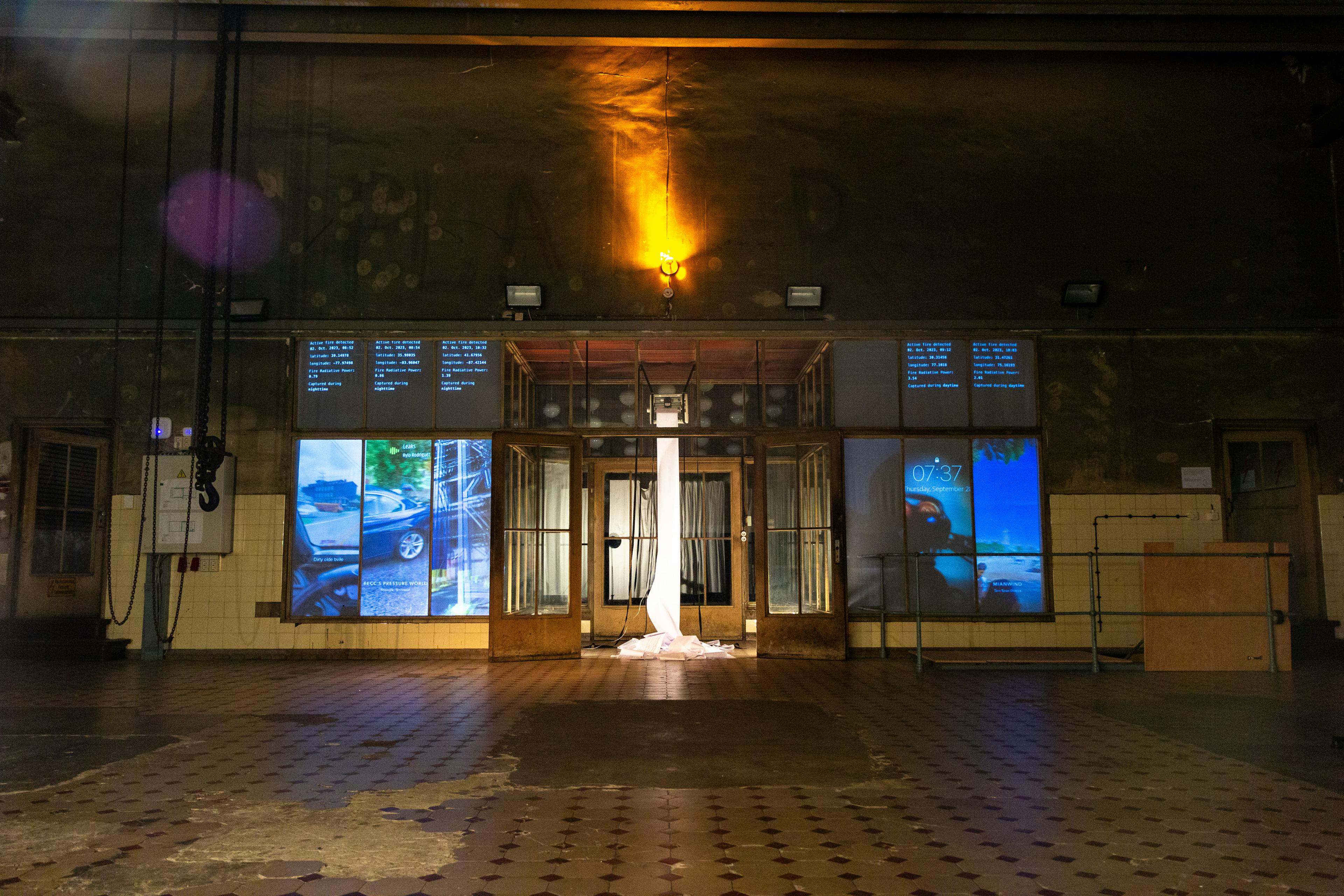
Dot matrix printer, mapped projection, active fire real-time satellite data
770 x 280 x 280 cm
To detect fires around the world, research satellites continuously monitor the Earth and take measurements. Captured from hundreds of kilometers away, specialised sensors can identify active fires in real time.
“Ground truthing” describes the process by which remotely sensed information is evaluated. By comparing data collected from a distance with physical measurements taken on the ground, results can be verified.
The installation “Ground Truth“ combines live satellite information of active fires with social media data from Snapchat. This app allows users to upload photos and videos with embedded geolocation, which can only be viewed for a single day. The combination of remotely sensed meassurements with current content creates a unique, real-time ground truth that wouldn't be possible to obtain in any other way.
This project was developed in collaboration with the Biogeochemical Department of the Max Planck Society, ELLIS Unit Jena and the Faculty of Mathematics and Computer Science at the Friedrich Schiller University of Jena as part of künstlerische Tatsachen Art & Science residency.

Awake with a stranger´s shoes on
Gallery Discotec
6. June - 11. July 2024, Vienna / Austria


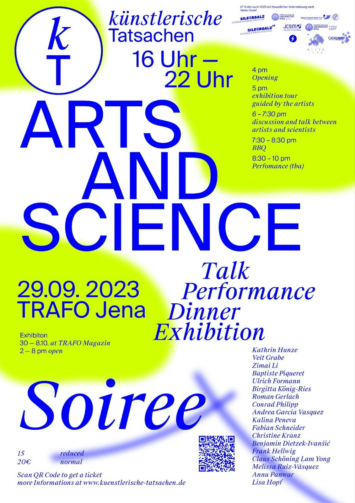
künstlerische Tatsachen Arts & Science Soiree
TRAFO
30. September - 8. October 2023, Jena / Germany
Remote Realities
Museum Prediger
10. April - 21. June 2025, Schwäbisch Gmünd / Germany


Notes On Rescue
Alte Feuerwache THF
14. August - 17. October 2025, Berlin / Germany


